History · Before 1244
The first diversion
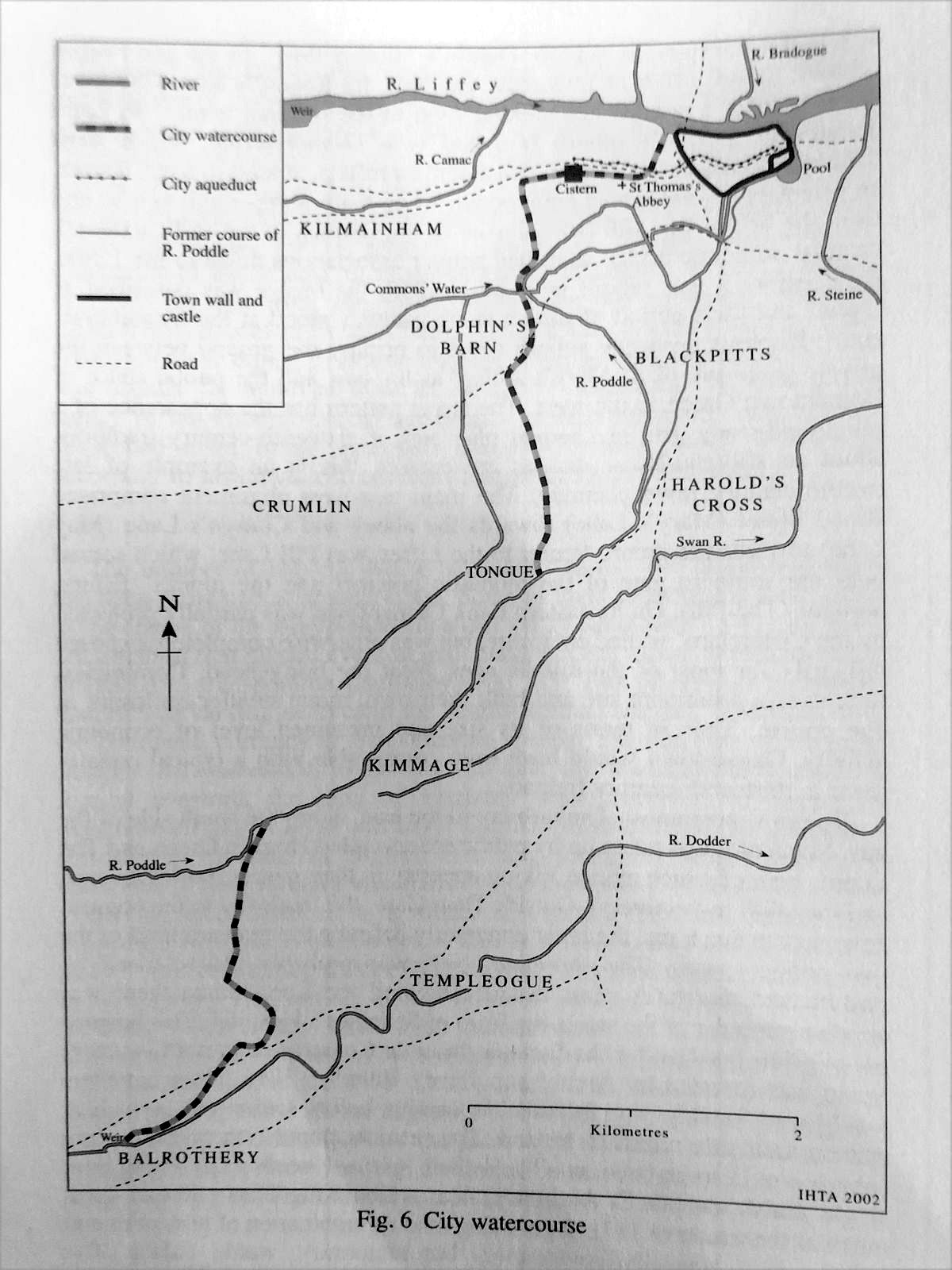
Turning the Dodder into the Poddle at Balrothery.
The first diversion
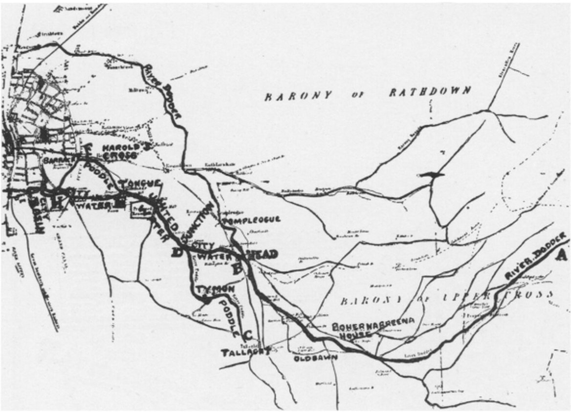
The first great change was the diversion of water from the Dodder into the Poddle at Balrothery Weir, near Firhouse. It was a remarkable piece of engineering. Some 10km from St Thomas’s Abbey, a weir was built across the Dodder and a new channel dug that carried most of the river’s ordinary flow for about 3km to join the Poddle near Mount Down, in Kimmage.
It was done for two reasons. More water meant more power for the Abbey’s mills, and it gave the Abbey and the city a larger and steadier supply of drinking water, which was stored in a cistern outside James’s Gate, on what is now Thomas Street. The system ran for around 500 years.
The writ of 1244
The first firm date is 29 April 1244, when the justiciar, Maurice Fitzgerald, ordered the sheriff of Dublin to find out, “by twelve free and lawful men”, where water could best be taken “and conducted to the King’s city of Dublin, for the benefit of the city and at the cost of the citizens”. Anyone who got in the way could be arrested. The Dodder weir was chosen, enlarged and repaired, and in 1245 the King ordered water piped to his new hall in Dublin Castle by the following summer.
Who built the weir in the first place is less certain. Most accounts say the monks of St Thomas’s had it before 1244 and the citizens enlarged it. Others date the watercourse to between 1245 and 1254, or the weir itself to 1254, and one reading of the evidence puts the weir as early as the late 12th century. The Balrothery Weir page sets these out side by side.