Stop 15 of 19 · Thomas Street and James’s Street · on the City Watercourse
Guinness and St James’s Gate
Where Guinness got its water: not the Liffey but the Poddle, diverted by the monks in 1245 into the City Watercourse by a stone boat. Plus how Arthur Guinness defended that water with a pickaxe in 1775.
Where did Guinness get its water?
Not from the Liffey, as people often say, but from the Poddle, which was diverted by the monks of St Thomas’s Abbey in 1245 into the City Watercourse by a stone boat. The Stone Boat, just east of Sundrive Road in Kimmage, is a stone shaped like the bow of a boat, set in the river where the water brought from the Dodder at Balrothery joins the Poddle. It splits the flow two to one: two thirds stay in the Poddle, and one third goes off into the City Watercourse, an artificial channel that runs north to Dolphin’s Barn and then east along James’s Street to the city. It was rebuilt in 1555, and the stone there today is a modern replacement on the same design. Arthur Guinness’s lease of 1759 gave him that water free, as the next section shows.
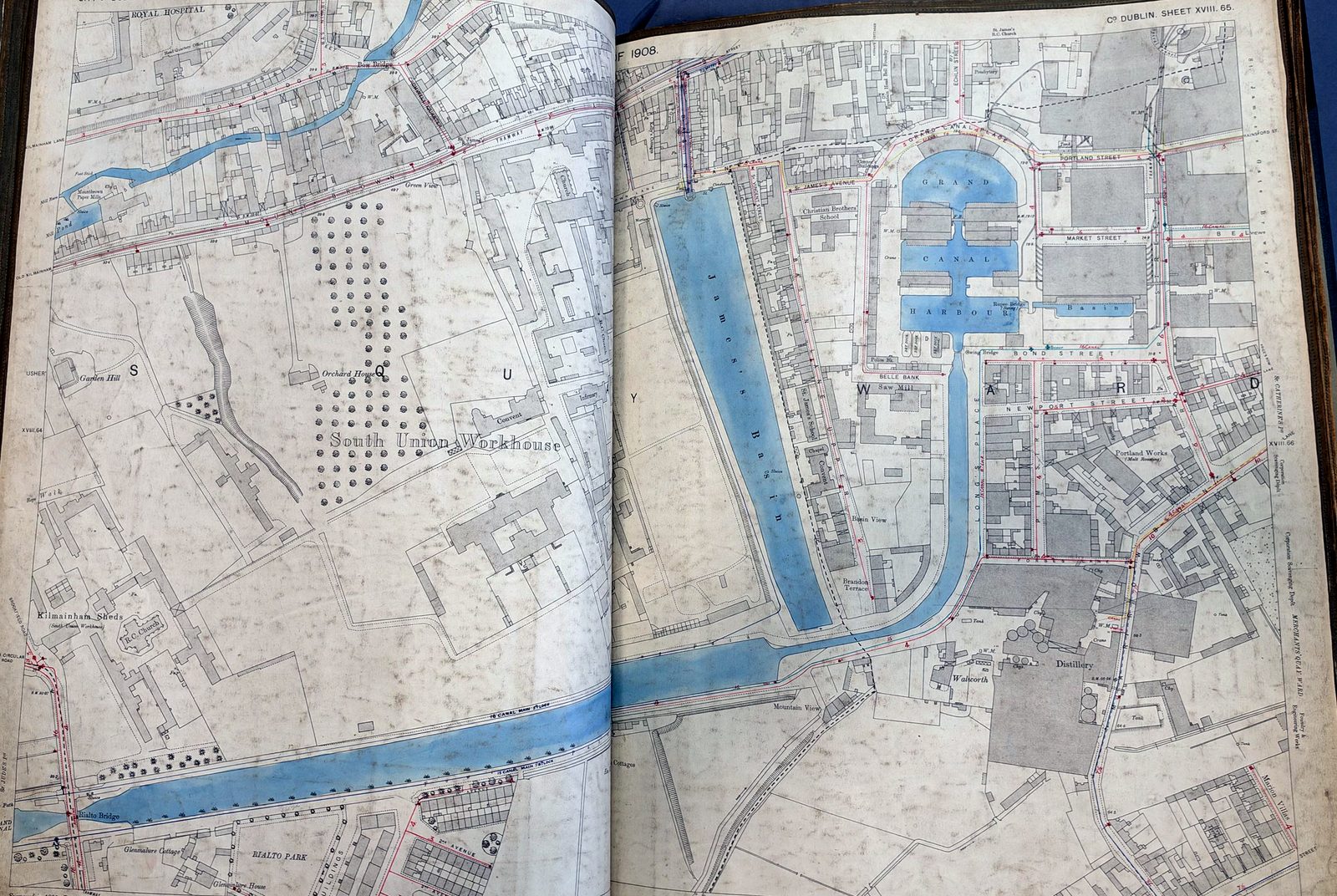
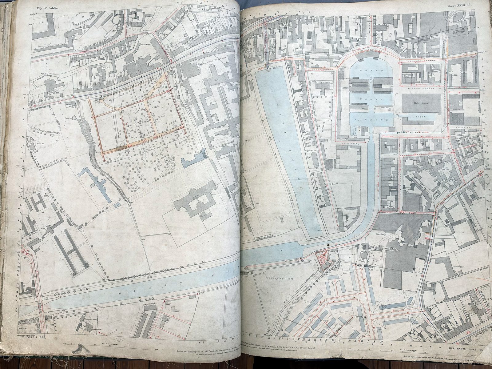
St James’s Gate was the western gate of the medieval city, on the road out past St Thomas’s Abbey. The City Watercourse, topped up from the Dodder, came in from Dolphin’s Barn along the Back of the Pipes, and a public cistern outside the gate is recorded from the 13th century. From 1721 the water was stored in the new City Basin off James’s Street, a few minutes’ walk south-west of the gate. For the brewers, maltsters and distillers along James’s Street and Thomas Street that water was everything: the Liffey was tidal and fouled, and could not be used for brewing.
Source: D. McEntee and M. Corcoran, The Rivers Dodder and Poddle; Betty Brunkard, Basin Street Harbour (2014); Come Here To Me (2015).
Arthur Guinness’s lease
On 31 December 1759 Arthur Guinness, then 34, took a lease of a small, disused brewery at St James’s Gate from Mark Rainsford, for 9,000 years at £45 a year. The Guinness Archive has shared the clause about the water. It gave him:
“free use Liberty and privilidge of the said Pipe water or City Water Course Lying on the west of the premisses gratis and without any Consideration to be paid for the same as held and Enjoyed by the said Sir Mark Ransford for Brewing and Malting”, and the right to bring “Horses Carts Drays and Carriages” through the back way from Ransford Street.
So the first Guinness was brewed with water that had come down the City Watercourse from the Poddle and the Dodder, past Templeogue, Kimmage and Dolphin’s Barn.
Source: lease of 31 December 1759, extract courtesy of the Guinness Archive, Diageo Ireland.
The pickaxe, 1775
Free water did not stay free for long. In 1772 a Corporation committee found two oversized pipes taking water into the brewery, and the city claimed Guinness was using far more than his lease allowed. On 16 May 1775 the committee came with the Sheriff and a gang of workmen to fill in the channel from the watercourse. Guinness, the committee reported, seized a pickaxe from one of the labourers, said that if they filled it up from end to end he would open it again at once, and that “the water was his, and he would defend it by force of arms”. The committee withdrew.
The dispute ran on for almost ten years. It ended in a compromise: by one account on 24 May 1784, by another in 1785, Guinness agreed to take a lease of the water for the rest of his 9,000 years, at £10 a year.
Source: Come Here To Me, “Arthur Guinness and his Right2Water” (2015), quoting the Dublin Historical Record (1947).
The Guinness family by the Poddle
The family left its mark downstream too, on the island between the two streams of the Poddle. Arthur’s grandson, Sir Benjamin Lee Guinness, paid for the restoration of St Patrick’s Cathedral from 1860 to 1865, when it was feared it might collapse. His son Edward Cecil Guinness, Lord Iveagh, cleared the slums of the “Poddle valley” north of the cathedral, where houses were sinking into the river, and laid out St Patrick’s Park, opened in 1902. His Iveagh Trust built the Bull Alley flats between 1901 and 1906, then the Iveagh Hostel and Iveagh Baths on Bride Road and, in 1915, the Iveagh Play Centre facing the cathedral. To give the new buildings firm ground the Corporation moved part of the Poddle’s course, with £1,400 from Lord Iveagh towards the new channel.
Many brewery families lived along the river’s course. Around Blackpitts, many of Mary Agnes Hammond’s tenants were Guinness workers, and their deeds carried the right to wash in the River Poddle.
Source: The Iveagh Trust, “The Vision for Bull Alley”; Dublin Corporation minutes, 1902.
Filming the watercourse
The brewery even had a hand in the river’s first film. In the spring of 1968 Mike Lawlor of the Brewers’ Laboratory, chairman of the Guinness Film Society, gathered a few colleagues to make films as well as show them. Their first, a 27-minute colour film following a small sailing boat down the Liffey from its source in Wicklow to the Port of Dublin, was finished by early 1969 and a copy went to RTÉ; John Gleeson, also of the Brewers’ Laboratory, was one of the group. In November 1970 the brewery’s staff newsletter said the group’s next project, then being scripted, was “a definitive work on ‘The Liberties’”, to record what remained of “this unique area of Dublin”, and by 1972 Gleeson had been down the Barrow navigation by boat with a camera.
That summer he was filming the City Watercourse between Firhouse and Kimmage, with narration by Sister Ann Dominica Fitzgerald. The Guinness Archive tells us the Film Society gave its films to the Irish Film Institute, so if the watercourse film, or the Liberties one, survives it should be there. The search goes on.
Source: Evening Herald, 25 July 1972; The Harp (Guinness staff magazine), Autumn 1968, Spring 1969 and Spring 1972, and St James’s Gate newsletters, March 1969 and November 1970, courtesy of the Guinness Archive, Diageo Ireland.
Poddle People
- Arthur Guinness: Brewed with the City Watercourse
- Sir Benjamin Lee Guinness: Restored St Patrick’s on its island
- Lord Iveagh (Edward Cecil Guinness): Rebuilt the Poddle valley