The Poddle

History · The mills

Mill sites

The mills of the Poddle, one by one

Nine mill sites, some of them groups of neighbours, from Templeogue to New Street, in order from source to sea. Select a mill marker on the map to land on its entry here.

Templeogue No map marker

Mount Down Mill (Domville Mill)

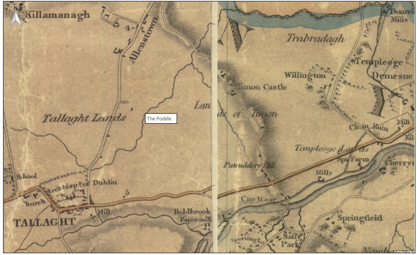
Duncan’s 1821 map of Dublin shows Domville Mill at Templeogue, upstream of Kimmage. Old accounts of the City Watercourse say the Poddle joined it at Mount Down Flour Mills. The 1906 to 1909 Ordnance Survey map labels it Mount Down Mill and shows it as disused. Local histories use the mill to mark the end of the Tymon River section.

Duncan’s map of the County of Dublin, 1821, showing the Poddle flowing north-east from Tallaght. Figure 11-6. From the River Poddle flood scheme environmental impact assessment report, Chapter 11 (An Bord Pleanála case 306725).
Historic: Duncan’s map of the County of Dublin, 1821, showing the Poddle flowing north-east from Tallaght. Figure 11-6. From the River Poddle flood scheme environmental impact assessment report, Chapter 11 (An Bord Pleanála case 306725).
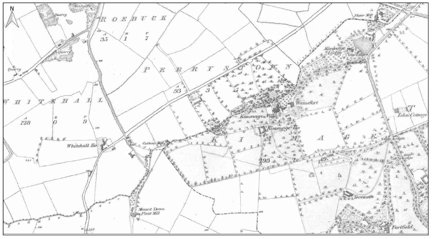
Ordnance Survey six-inch map, 1843, showing the Poddle through Kimmage, with the Mount Down flour mill at lower left. Figure 11-7. From the River Poddle flood scheme environmental impact assessment report, Chapter 11 (An Bord Pleanála case 306725).
Historic: Ordnance Survey six-inch map, 1843, showing the Poddle through Kimmage, with the Mount Down flour mill at lower left. Figure 11-7. From the River Poddle flood scheme environmental impact assessment report, Chapter 11 (An Bord Pleanála case 306725).

Kimmage Road Lower and Kimmage Cross Roads Farrington’s site approximate

Ravensdale Mills and Farrington’s Mill

Two mills worked side by side on this stretch. Ravensdale Mills was a corn and flour mill with its own pond, sluice and weir, on maps from the 1830s until 1940. Farrington’s Mill, beside Kimmage Cross Roads, was a flour mill that worked by water turbine until the 1920s. The 1843 Ordnance Survey map also shows Cutlers Mill and its millrace, and a flour mill with a pond in the Kimmage demesne, and the flood scheme’s heritage report says remains of the Ravensdale mill and Cutlers millrace may survive below ground. Ravensdale Park, beside the site, is one of the places being reshaped to store flood water in the flood alleviation scheme.

Ordnance Survey six-inch map, 1843, showing the Poddle through Kimmage, with the Mount Down flour mill at lower left. Figure 11-7. From the River Poddle flood scheme environmental impact assessment report, Chapter 11 (An Bord Pleanála case 306725).
Historic: Ordnance Survey six-inch map, 1843, showing the Poddle through Kimmage, with the Mount Down flour mill at lower left. Figure 11-7. From the River Poddle flood scheme environmental impact assessment report, Chapter 11 (An Bord Pleanála case 306725).
The Poddle in Kimmage, 2007
Today: The Poddle in Kimmage, 2007. JP, CC BY-SA 2.0

Sundrive Shopping Centre and St Martin’s Drive Approximate site

Larkfield Mills and the St Martin’s Drive mill

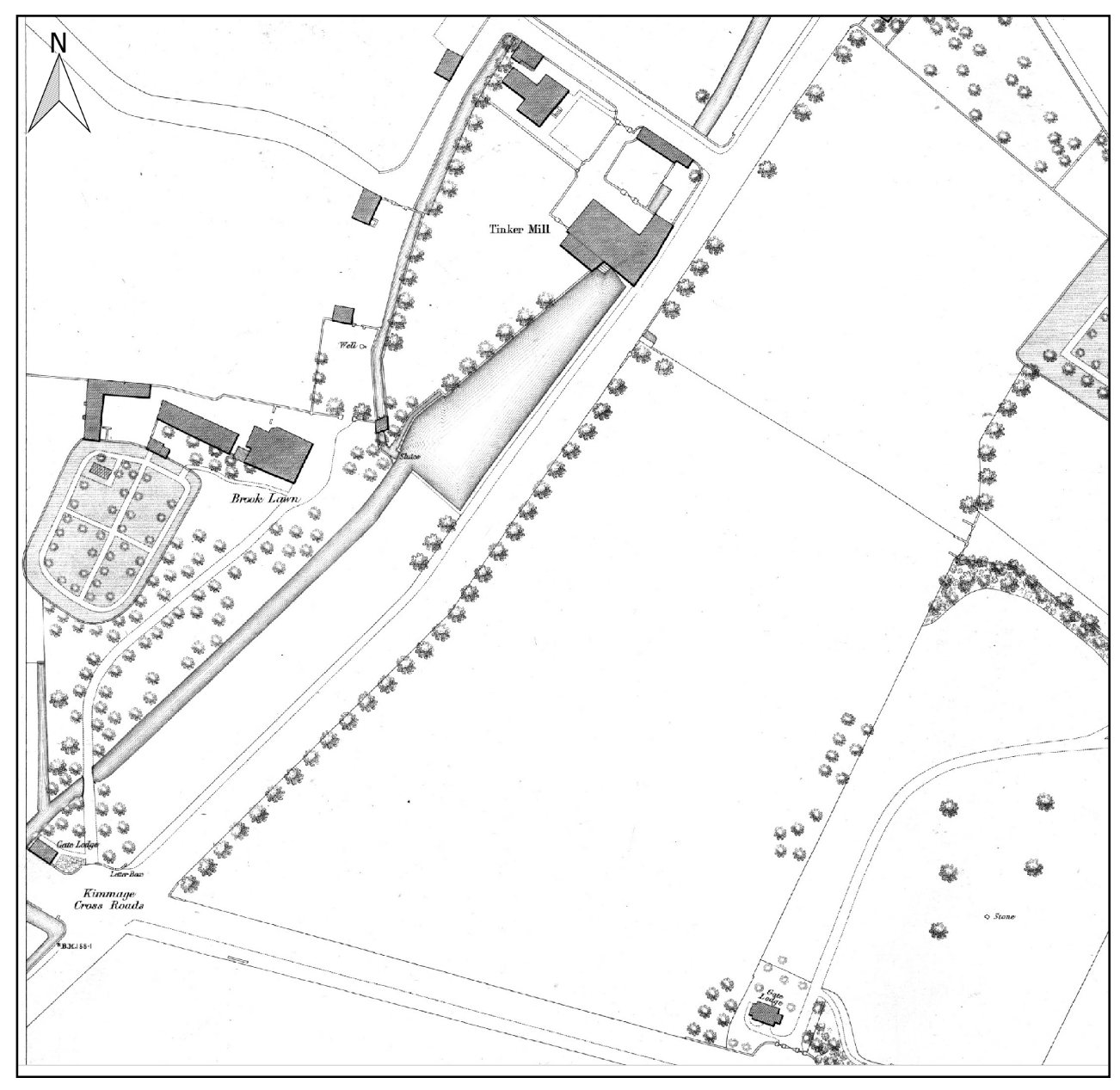
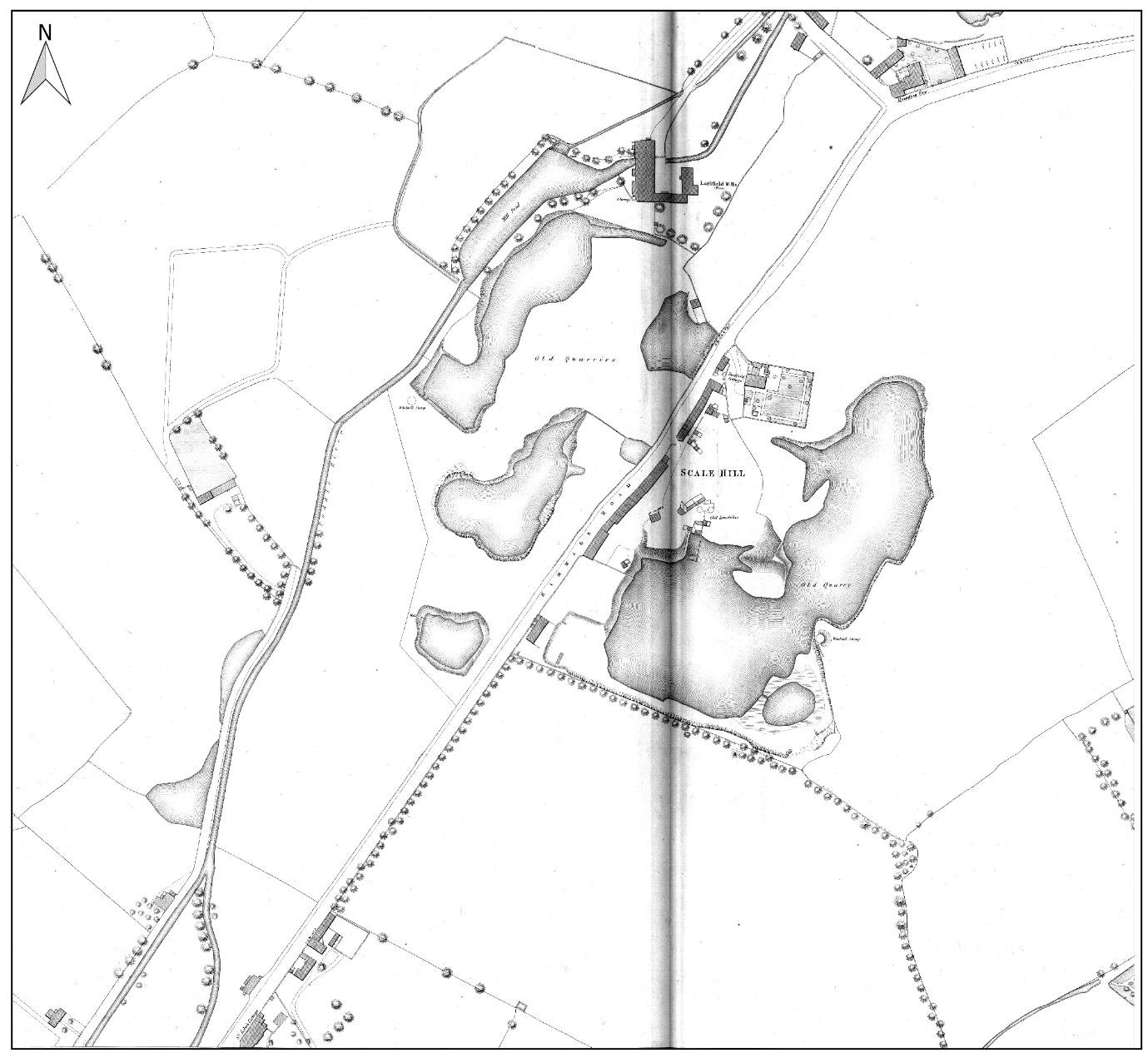
Larkfield Mills, a mill with its pond, stood where the Sundrive Shopping Centre is now, and the name Larkfield survives in the area. Close by, near St Martin’s Drive, the first Ordnance Survey map shows another mill, a pond and a windmill together. The 1876 map names Tinker Mill and Larkfield Mill in the Brook Lawn and Sundrive Road area.

Ordnance Survey five-foot map, 1876, showing Tinker Mill and Brook Lawn. Figure 11-9. From the River Poddle flood scheme environmental impact assessment report, Chapter 11 (An Bord Pleanála case 306725).
Historic: Ordnance Survey five-foot map, 1876, showing Tinker Mill and Brook Lawn. Figure 11-9. From the River Poddle flood scheme environmental impact assessment report, Chapter 11 (An Bord Pleanála case 306725).
Ordnance Survey five-foot map, 1876, showing Larkfield Mill and its ponds. Figure 11-10. From the River Poddle flood scheme environmental impact assessment report, Chapter 11 (An Bord Pleanála case 306725).
Historic: Ordnance Survey five-foot map, 1876, showing Larkfield Mill and its ponds. Figure 11-10. From the River Poddle flood scheme environmental impact assessment report, Chapter 11 (An Bord Pleanála case 306725).
The Poddle at Poddle Park, Kimmage, today
Today: The Poddle at Poddle Park, Kimmage, today. O’Dea, CC BY-SA 4.0

Kimmage Road Lower Approximate site

Loader’s Park Mills

Local histories describe a corn mill on Kimmage Road Lower, and the building survives as the Waterwheel apartments. The flood scheme’s heritage report lists Loader’s Park Mill as a paper mill on the 1906 to 1909 map, south-east of Mount Argus, so the site may have changed use over time. The report finds no significant impact on its millrace.

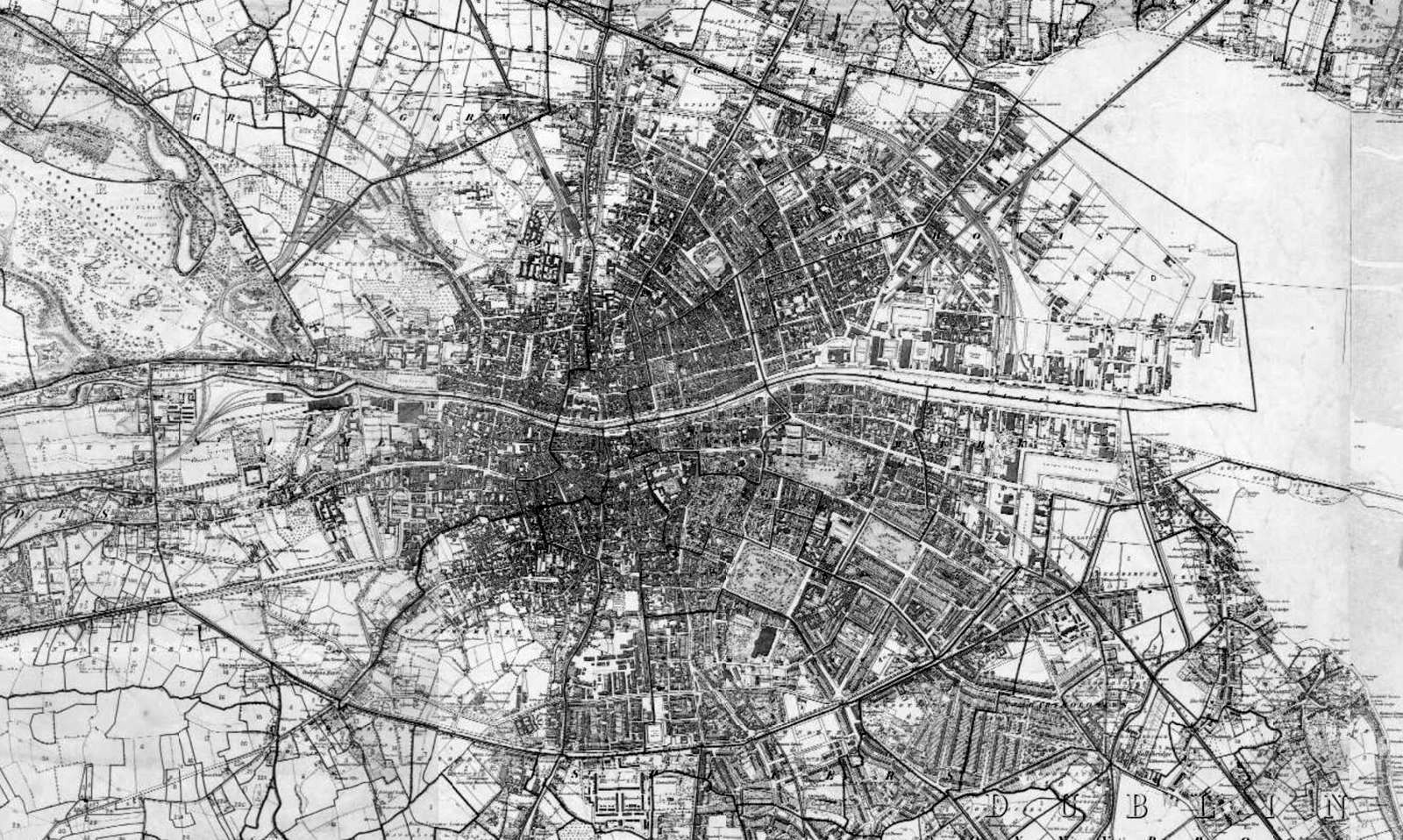
Griffith’s Valuation map of Dublin, mid-19th century
Historic: Griffith’s Valuation map of Dublin, mid-19th century

Mount Argus Road

Mount Argus mills

In the 19th century there was a paper mill here, and a flour mill on Mount Argus Road that later became a laundry. The Stone Boat, where the river divides, is nearby.

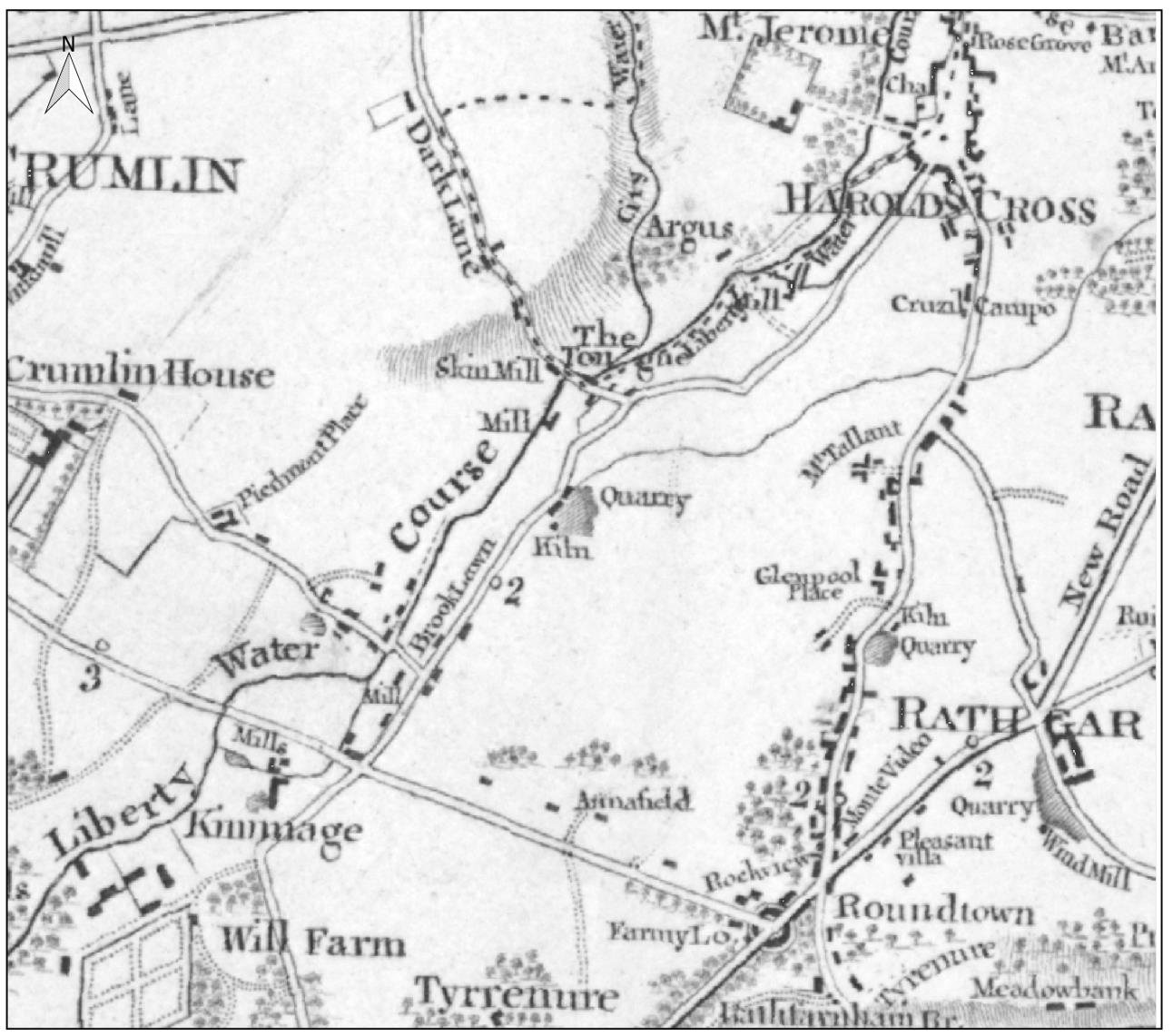
Taylor’s map of the environs of Dublin, 1816, from Kimmage to Harold’s Cross, with the Tongue and a mill. Figure 11-5. From the River Poddle flood scheme environmental impact assessment report, Chapter 11 (An Bord Pleanála case 306725).
Historic: Taylor’s map of the environs of Dublin, 1816, from Kimmage to Harold’s Cross, with the Tongue and a mill. Figure 11-5. From the River Poddle flood scheme environmental impact assessment report, Chapter 11 (An Bord Pleanála case 306725).
The Poddle by Mount Jerome Cemetery, 2013
Today: The Poddle by Mount Jerome Cemetery, 2013. jwd, CC BY-SA 2.0

Harold’s Cross Park

Harold’s Cross Park watermill

One of several 19th-century watermills in Harold’s Cross village. Another was a flour mill by the gates of Mount Jerome.

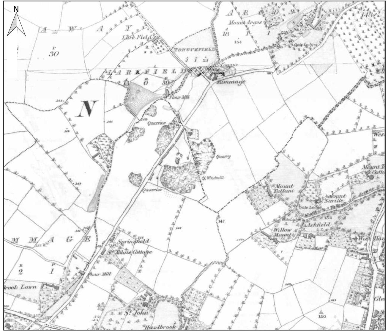
Ordnance Survey six-inch map, 1843, from Kimmage towards Harold’s Cross. Figure 11-8. From the River Poddle flood scheme environmental impact assessment report, Chapter 11 (An Bord Pleanála case 306725).
Historic: Ordnance Survey six-inch map, 1843, from Kimmage towards Harold’s Cross. Figure 11-8. From the River Poddle flood scheme environmental impact assessment report, Chapter 11 (An Bord Pleanála case 306725).
The Poddle by Mount Jerome Cemetery, 2013
Today: The Poddle by Mount Jerome Cemetery, 2013. jwd, CC BY-SA 2.0

Greenmount and Our Lady’s Hospice, Harold’s Cross

Greenmount Mills and the Hospice mill pond

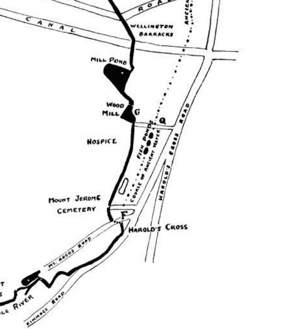
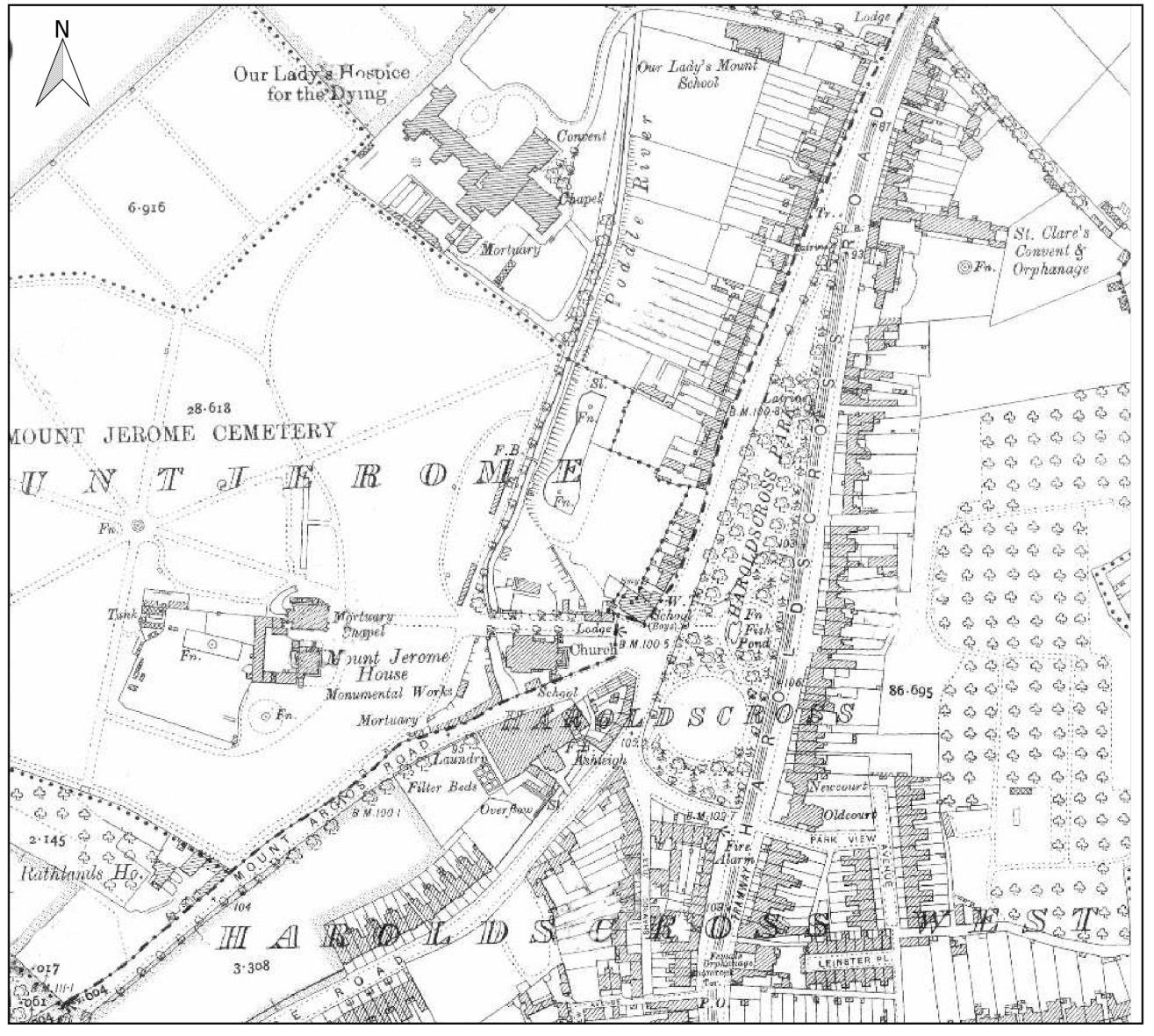
The National Monuments Service records a mill site here. Greenmount was a corn mill that became a cotton mill by 1807 and was enlarged by the Quaker Pim family for cotton and linen. Beside it, a mill pond by Our Lady’s Hospice is shown on the 1910 Ordnance Survey map, and Rev. Myles Ronan’s 1927 map shows a mill pond and a Wood Mill on this part of the river, with the dotted line of an older water course beside them. Greenmount’s mill pond was among the last to disappear, covered over in the late 1960s. The lanes around it now hold small businesses.

Rev. Myles Ronan’s 1927 map of the Poddle at Harold’s Cross, marking the Wood Mill and a mill pond
Historic: Rev. Myles Ronan’s 1927 map of the Poddle at Harold’s Cross, marking the Wood Mill and a mill pond
Ordnance Survey 25-inch map, 1906 to 1909, showing Mount Jerome and Harold’s Cross. Figure 11-11. From the River Poddle flood scheme environmental impact assessment report, Chapter 11 (An Bord Pleanála case 306725).
Historic: Ordnance Survey 25-inch map, 1906 to 1909, showing Mount Jerome and Harold’s Cross. Figure 11-11. From the River Poddle flood scheme environmental impact assessment report, Chapter 11 (An Bord Pleanála case 306725).
Greenmount Lane today, home to small businesses
Today: Greenmount Lane today, home to small businesses. William Murphy, CC BY-SA 2.0

Mill Street and Sweeney’s Lane Approximate site

Double mill, Mill Street

An oil and flour mill, linked to St Thomas’s Abbey, which gave Mill Street its name. Mill Street is first mentioned in 1711. By 1830 the street had several tanners and a fancy weaver, and by 1880 five tanners and a parchment maker.

Griffith’s Valuation map of Dublin, mid-19th century
Historic: Griffith’s Valuation map of Dublin, mid-19th century

New Street, beside St Nicholas’ Bridge

Medieval mill, Cross Poddle

A medieval mill beside St Nicholas’ Bridge, outside St Nicholas’ Gate, at the junction of New Street, Patrick Street and Kevin Street. The old Cross Poddle ran beside it.

Griffith’s Valuation map of Dublin, mid-19th century
Historic: Griffith’s Valuation map of Dublin, mid-19th century

Almost nothing of these mills is left to see, so the “today” photographs show the river or the street at or near each site, not the mill itself. Sites marked approximate are placed from old maps and local histories. If you have a photograph or a memory of any of them, get in touch.